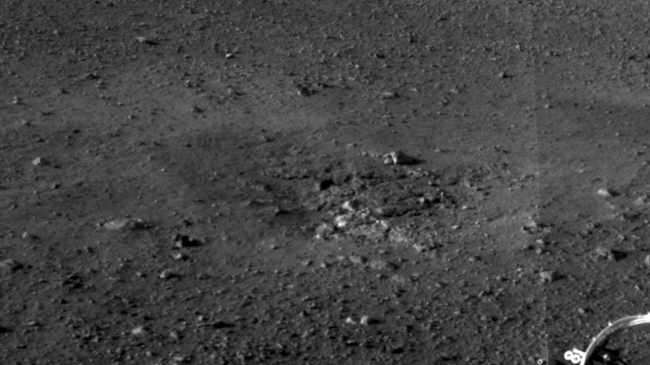
Rocket Thrusters Expose Bedrock, This is a close-up view of the zones where the soil at Curiosity's landing site was blown away by the thrusters on the rover's descent stage. The excavation ...

Rocket Thrusters Expose Bedrock


This is a close-up view of the zones where the soil at Curiosity's landing site was blown away by the thrusters on the rover's descent stage. The excavation of the soil reveals probable bedrock outcrop. This is important because it shows the shallow depth of the soil in this area. The area surrounding the zones of excavation shows abundant small rocks that may form a pavement-like layer above harder bedrock. This full-resolution image was taken by the rover's Navigation camera. JPL manages the Mars Science Laboratory/Curiosity for NASA's Science Mission Directorate in Washington. The rover was designed, developed and assembled at JPL, a division of the California Institute of Technology in Pasadena. For more about NASA's Curiosity mission, visit: http://www.jpl.nasa.gov/msl , http://www.nasa.gov/mars , and http://marsprogram.jpl.nasa.gov/msl .

Image credits: NASA/JPL-Caltech
Image released by NASA on 2012-08-08 as catalog id PIA16025
This photo was taken 12 years ago and uploaded to photonado 11 years ago
24 views.

Photostream

photo: photo: photo: photo: photo:

Tags

License

cc-by-nc Attribution-NonCommercial

Privacy

This photo is visible for everyone

Flag this photo

Flag this photo

Metadata

Original size:  1280x720
Full metadata.

Share this photo

Link to this photo
Embed this photo